


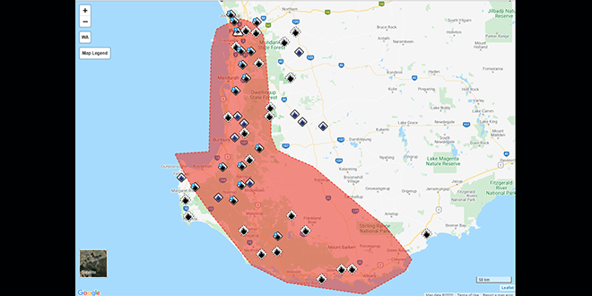
Take action with severe weather coming in parts of the Perth Metropolitan, Great Southern, South West, Lower South West & Goldfields-Midlands.
If you live in Lower West, South West and parts of South Coastal and Great Southern districts you should take action and stay safe with severe weather to come.
Locations which may be affected include Albany, Bunbury, Busselton, Mandurah, Manjimup, Mount Barker and Perth
This is typical weather for this time of year but winds may cause damage to property and make road conditions hazardous.
WHAT TO DO:
DFES advises you to:
• If outside find safe shelter away from trees, powerlines, storm water drains and streams.
• Close your curtains and blinds, and stay inside away from windows.
• Unplug electrical appliances and avoid using landline telephones if there is lightning.
• If there is flooding, create your own sandbags by using pillow cases filled with sand and place them around doorways to protect your home.
• If boating, swimming or surfing leave the water.
IF DRIVING:
• Do not drive into water of unknown depth and current.
• Slow down, turn your lights on and keep a safe distance from other drivers.
• Be alert and watch for hazards on the road such as fallen powerlines and loose debris.
• If it is raining heavily and you cannot see, pull over and park with your hazard lights on until the rain clears.
People are being urged to do what they can to help themselves, if it is safe to do so, before calling the SES for assistance
WEATHER DETAILS:
At 04/05/2020 11:26:00 the Bureau of Meteorology advised A cold front passing through the southwest of the State Monday will affect mainly coastal communities of the Lower West and South West.Showers and isolated thunderstorms associated with the passage of the front may produce DAMAGING WINDS with gusts of up to 100km/h possible that could cause DAMAGE TO HOMES AND PROPERTY in localised areas.DAMAGING WINDS and HEAVY RAINFALL that may lead to FLASH FLOODING is possible about mainly coastal locations of the Lower West and South West districts. DAMAGING WINDS as well are possible for the western parts of the South Coastal and Great Southern districts.DAMAGING WINDS are most likely to occur on or just ahead of the leading edge of the cold front. Conditions will ease throughout the warning area by mid-afternoon.The warning area for communities southwest of a line Cape Naturaliste to Windy Harbour has been cancelled.Another, stronger cold front will affect the Southwest Land Division during Tuesday afternoon and evening and is likely to produce WIDESPREAD DAMAGING WINDS.
ROAD CLOSURES AND CONDITIONS:
Roads have not been closed.
Take extra care on the roads and do not drive into water of unknown depth and current.
Road information may also be available from Main Roads WA by calling 138 138 or visiting travelmap.mainroads.wa.gov.au or by contacting your local Shire.
WHAT EMERGENCY SERVICES ARE DOING:
• DFES is monitoring the situation.
IF YOU NEED ASSISTANCE:
• If your home has been badly damaged by a storm, call the SES on 132 500
• In a life threatening situation call 000
After a storm SES volunteers make temporary repairs to homes that have been badly damaged, such as roofs that have been ripped off or large fallen trees on homes or cars. Please contact your insurance company to organise permanent repairs.
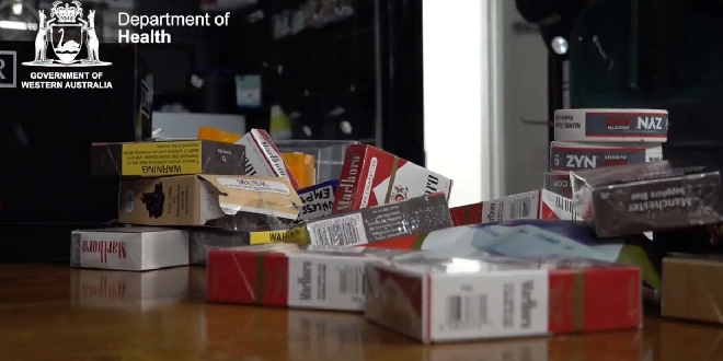 Nearly 50 tobacco stores closed, over five million cigarettes seized under new laws
 Yarloop man fined thousands, rods forfeited over illegal fishing haul
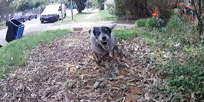 Rockingham named a state hotspot for dog-related incidents against posties
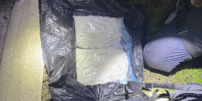 Police uncover 2kg of meth during crackdown on impaired drivers in Mandurah
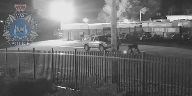 WATCH: Police release vision of Barragup arsonist
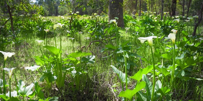 Local landholders encouraged to work together against invasive weed
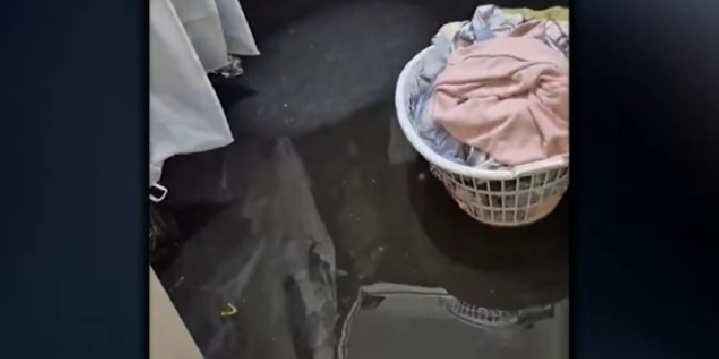 Wellard family provided temporary accommodation after burst water pipe floods home
 Elderly woman taken to hospital after crash on the Kwinana Freeway in Baldivis
 Pop-up ice skating rink glides back into Mandurah for winter school holidays